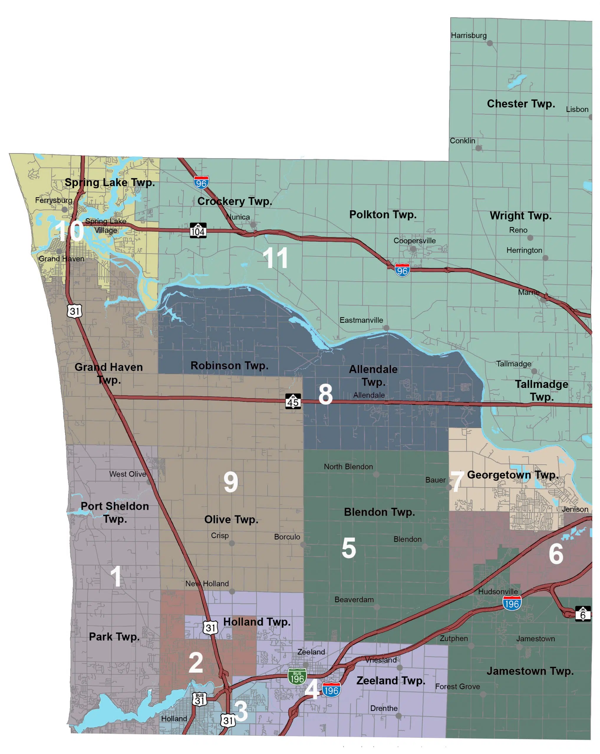
HOLLAND (WHTC-AM/FM) — Members of Ottawa County’s reapportionment commission held their first meeting, and will be considering which software will help determine the borders of future districts for the next 10 years. They can have as few as five districts or as many as 21; each district is represented by a county commissioner. Currently, Ottawa County has 11 commissioners.
Members of the board, Ottawa County Prosecuting Attorney Lee Fisher; Clerk Justin Roebuck, Treasurer Amanda Price, and leaders of the county’s political parties: Republican Rett DeBoer and Democrat Tim Smith. The first order of business, selecting a permanent chair, was completely uncontentious.
Smith nominated Roebuck, which DeBoer seconded; Fisher nominated Price, which Roebuck seconded, saying he respectfully wanted to remove his own name from the nomination list. Board members voted unanimously to elect Price.
Price had earlier noted she served in 2011 as a state-level redistricting commission member. She did a brief review of rules, which the board adopted.
Then the group heard and watched a presentation by Shane Pavlak, the county’s geographic information system supervisor.
One option is software created by ESRI $5,000 per use license, but he said the county could probably “get away with” using one user license, with one person using it at a time.
Roebuck said the county’s website would include a page where people can see all documents related to the commission’s work, giving the public access, because it’s cloud-based.
The other main tools were ArcGIS, would be free but require the purchase of a map and someone using it to have advanced knowledge of the software; Maptitude, a web- and subscription-based application; a free open-source DistrictBuilder, which wouldn’t have the same level of support as other packages.
Price wanted to know what other county’s were using and what budget the Ottawa County reapportionment commission had. Roebuck said the initial funding is just $5,000, but they could either ask for more money as needed or, should they not spend the initial $5,000, return the remainder to the county.
Pavlak suggested using the ESRI package, because county officials are familiar with it, the data is automatically loaded, and the features offered easy ways to share data and show the public what is being done.
Price asked about how quickly the county would be getting data from the state. Roebuck said the current estimate for getting the data is mid-September, which is later than the process typically happens, because of pandemic-related delays.
The full video of the public meeting is available online, via YouTube video, or as a WHTC podcast: https://omny.fm/shows/whtcs-morning-news-podcast/ottawa-co-reapportionment-commission-first-meeting.


Comments